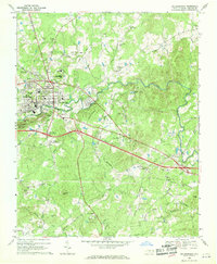
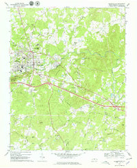
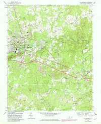
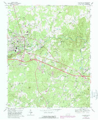
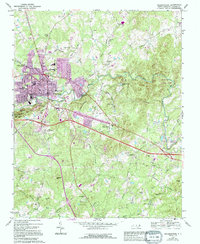
1968 Map of Hillsborough
USGS Topo · Published 1970About this map
Hillsborough and West Hillsborough serve as the focal points of this late 1960s survey, situated along the winding course of the Eno River. The map reveals a landscape defined by its educational and civic institutions, featuring Orange High Sch, Central High Sch, and the unique County Subsidiary Prison No 056. Traces of the area's deeper history are evident in the Governor Burke Grave and numerous rural houses of worship like Mary Hill Ch and St Marys Ch.
Find a feature on this map
71 named features on this map. Tap any name to fly to it.
Don’t see what you’re looking for? This feature index may not catch every label — zoom into the map to look around manually.
Map Details
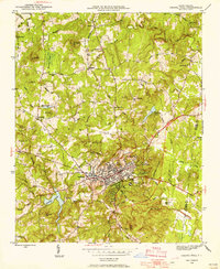
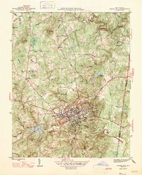
Editions of this 1968 Hillsborough Map
5 editions found
Other maps of this area

1943 · Durham South
USGS Topo · 1:62,500
1946 · Chapel Hill
USGS Topo · 1:24,000
1947 · Chapel Hill
USGS Topo · 1:31,680

1951 · Durham South
USGS Topo · 1:62,500

1951 · Durham North
USGS Topo · 1:62,500

1953 · Raleigh
USGS Topo · 1:250,000

1953 · Greensboro
USGS Topo · 1:250,000

1954 · Greensboro
USGS Topo · 1:250,000

1954 · Raleigh
USGS Topo · 1:250,000

1962 · Greensboro
USGS Topo · 1:250,000