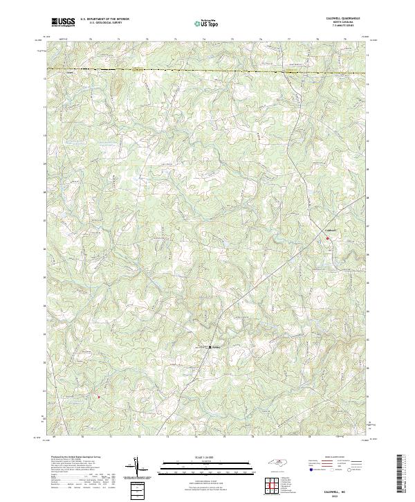
2022 Map of Caldwell
USGS Topo · Published 2022About this map
Caldwell and Schley anchor this rural landscape in the northern reaches of Orange County, where the headwaters of the Little River system carve through the terrain. The map captures a transition point near the border with Person County, defined by a network of family-named roads such as Wagner Dairy Rd and Ewart Berry Rd that suggest long-standing land holdings. Notable local landmarks include the Payne Chapel AME Church Cem near Schley, providing a clear point of reference for genealogists and local historians tracking the community's social and religious history. The geography is heavily influenced by water, featuring both the N Fork Little River and the S Fork Little River, alongside significant local impoundments like Quail Roost Lake Number Three. The concentration of named roads and creek crossings reflects a persistent agricultural and residential pattern that has defined this part of the North Carolina piedmont for generations.
Find a feature on this map
113 named features on this map. Tap any name to fly to it.
Don’t see what you’re looking for? This feature index may not catch every label — zoom into the map to look around manually.
Map Details
Editions of this 2022 Caldwell Map
This is the sole edition of this map. No revisions or reprints were ever made.
Other maps of this area

1943 · Roxboro
USGS Topo · 1:62,500

1951 · Durham North
USGS Topo · 1:62,500

1953 · Greensboro
USGS Topo · 1:250,000

1954 · Greensboro
USGS Topo · 1:250,000

1962 · Greensboro
USGS Topo · 1:250,000

1966 · Greensboro
USGS Topo · 1:250,000

1967 · Cedar Grove
USGS Topo · 1:24,000

1968 · Efland
USGS Topo · 1:24,000
1968 · Hillsborough
USGS Topo · 1:24,000

1968 · Caldwell
USGS Topo · 1:24,000