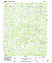
1997 Map of Caldwell
USGS Topo · Published 2000About this map
North Fork Little River and South Fork Little River converge within this rural landscape of northern Orange County, defining the drainage patterns for a region historically centered on small farming communities. Small settlements like Caldwell and Schley serve as local hubs, while the map reveals a dense distribution of rural congregations that have anchored these neighborhoods for generations. The frequency of churches such as Berrys Grove Ch, Lattisville Grove Ch, and Obies Chapel Ch suggests a deeply rooted social structure tied to these specific landmarks.
Find a feature on this map
19 named features on this map. Tap any name to fly to it.
Don’t see what you’re looking for? This feature index may not catch every label — zoom into the map to look around manually.
Map Details
Editions of this 1997 Caldwell Map
This is the sole edition of this map. No revisions or reprints were ever made.
Other maps of this area

1943 · Roxboro
USGS Topo · 1:62,500

1951 · Durham North
USGS Topo · 1:62,500

1953 · Greensboro
USGS Topo · 1:250,000

1954 · Greensboro
USGS Topo · 1:250,000

1962 · Greensboro
USGS Topo · 1:250,000

1966 · Greensboro
USGS Topo · 1:250,000

1967 · Cedar Grove
USGS Topo · 1:24,000

1968 · Efland
USGS Topo · 1:24,000
1968 · Hillsborough
USGS Topo · 1:24,000

1968 · Caldwell
USGS Topo · 1:24,000