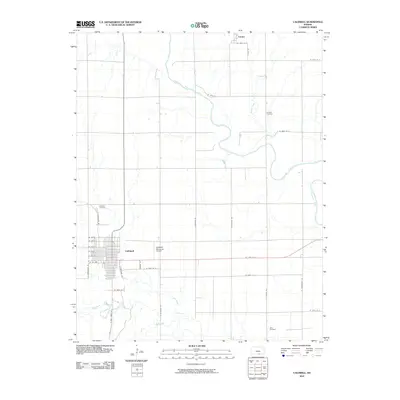
2010 Map of Caldwell
USGS Topo · Published 2010About this map
The Chikaskia River meanders across this Sumner County landscape, defining the rural geography north of the settlement at Caldwell. This 2010 survey illustrates a well-defined grid of section roads and the concentrated residential blocks of the city, where streets like W Ave G and S Cheyenne St transition into the surrounding agricultural tracts. Genealogy researchers will find several well-documented burial sites in the outlying areas, including Corzine Cemetery near Spring Creek and Alton Cemetery to the southeast. To the north, the small community of Corbin sits near the upper reaches of the river, while the Caldwell Municipal Airport serves as a modern transportation hub. The hydrologic network is a central feature of the map, as Fall Creek and Bluff Creek converge in the south, creating a complex series of drainage patterns that have likely influenced local land use and farm boundaries for generations.
Find a feature on this map
36 named features on this map. Tap any name to fly to it.
Don’t see what you’re looking for? This feature index may not catch every label — zoom into the map to look around manually.
Map Details
Editions of this 2010 Caldwell Map
This is the sole edition of this map. No revisions or reprints were ever made.
Other maps of this area

1889 · Caldwell
USGS Topo · 1:125,000

1890 · Wellington
USGS Topo · 1:125,000

1893 · Caldwell
USGS Topo · 1:125,000

1897 · Caldwell
USGS Topo · 1:125,000

1955 · Wichita
USGS Topo · 1:250,000

1955 · Enid
USGS Topo · 1:250,000

1958 · Enid
USGS Topo · 1:250,000

1958 · Wichita
USGS Topo · 1:250,000

1965 · South Haven
USGS Topo · 1:24,000

1965 · Rome
USGS Topo · 1:24,000