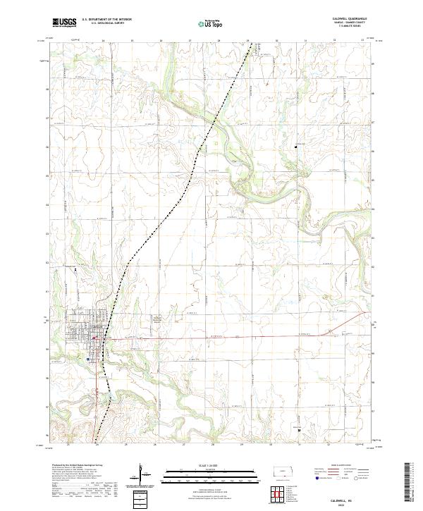
2022 Map of Caldwell
USGS Topo · Published 2022About this map
Caldwell anchors the southwestern portion of this Sumner County landscape, showing the town's grid and its relationship to the surrounding agricultural prairie. The settlement’s northern reach includes the Caldwell Cem, while the Caldwell Municipal Airport sits just to the east. The terrain is defined by the winding paths of several waterways, most notably Bluff Cr and its tributaries like Fall Cr, which meander through the southern sections of the township. Other drainage patterns include Rodgers Br and Spring Cr in the northeast. Scattered rural landmarks such as Corzine Cem and Alton Cem appear along the section lines, providing key points of interest for those tracing family history in the township roads north and east of the city center.
Find a feature on this map
98 named features on this map. Tap any name to fly to it.
Don’t see what you’re looking for? This feature index may not catch every label — zoom into the map to look around manually.
Map Details
Editions of this 2022 Caldwell Map
This is the sole edition of this map. No revisions or reprints were ever made.
Other maps of this area

1889 · Caldwell
USGS Topo · 1:125,000

1890 · Wellington
USGS Topo · 1:125,000

1893 · Caldwell
USGS Topo · 1:125,000

1897 · Caldwell
USGS Topo · 1:125,000

1955 · Wichita
USGS Topo · 1:250,000

1955 · Enid
USGS Topo · 1:250,000

1958 · Enid
USGS Topo · 1:250,000

1958 · Wichita
USGS Topo · 1:250,000

1965 · South Haven
USGS Topo · 1:24,000

1965 · Rome
USGS Topo · 1:24,000