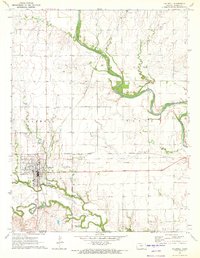
1971 Map of Caldwell
USGS Topo · Published 1973About this map
The Chikaskia River meanders across the landscape of southern Sumner County, shaping the terrain near the Oklahoma border. In the early 1970s, the town of Caldwell serves as a critical junction where the Chicago Rock Island and Pacific and the Atchison Topeka and Santa Fe railroads converge. This transit hub is further supported by the Caldwell Municipal Airport to the east. A notable historical marker on the sheet is the Old Indian Treaty Boundary, which runs east-west just south of the main settlement. The map also documents several smaller communities and landmarks, including the northern settlement of Corbin, local cemeteries such as Corzine Cem and Alton Cem, and industrial features like the Gravel Pits in the northeast. Waterways like Bluff Creek and Spring Creek feed into the river system, defining the local topography.
Find a feature on this map
20 named features on this map. Tap any name to fly to it.
Don’t see what you’re looking for? This feature index may not catch every label — zoom into the map to look around manually.
Map Details
Editions of this 1971 Caldwell Map
This is the sole edition of this map. No revisions or reprints were ever made.
Other maps of this area

1889 · Caldwell
USGS Topo · 1:125,000

1890 · Wellington
USGS Topo · 1:125,000

1893 · Caldwell
USGS Topo · 1:125,000

1897 · Caldwell
USGS Topo · 1:125,000

1955 · Wichita
USGS Topo · 1:250,000

1955 · Enid
USGS Topo · 1:250,000

1958 · Enid
USGS Topo · 1:250,000

1958 · Wichita
USGS Topo · 1:250,000

1965 · South Haven
USGS Topo · 1:24,000

1965 · Rome
USGS Topo · 1:24,000