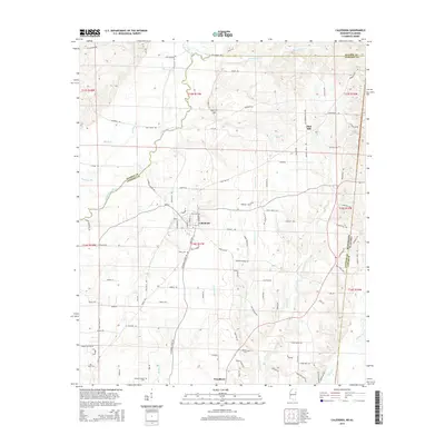
2015 Map of Caledonia
USGS Topo · Published 2015About this map
Caledonia serves as the central hub of this Mississippi borderland, where the Buttahatchee River meanders across the state line near the transition from Monroe County to Lowndes County. The landscape is defined by a dense network of local watercourses, including Honnoll Mill Creek and Grub Springs Branch, which cut through the terrain surrounding Flint Hill. For those researching family history in this corner of the South, the map identifies several local burial grounds, such as Egger Cemetery and Unity Cemetery. The settlement at Woodlawn and the Military Chapel Cemetery mark the southern reach of the survey. A complex web of rural routes like Seed Tick Road and Border Springs Road connects these smaller communities and agricultural homesteads, illustrating the enduring spatial organization of this rural region into the early twenty-first century.
Find a feature on this map
75 named features on this map. Tap any name to fly to it.
Don’t see what you’re looking for? This feature index may not catch every label — zoom into the map to look around manually.
Map Details
Editions of this 2015 Caledonia Map
This is the sole edition of this map. No revisions or reprints were ever made.
Other maps of this area

1953 · West Point
USGS Topo · 1:250,000

1958 · West Point
USGS Topo · 1:250,000

1960 · Caledonia
USGS Topo · 1:62,500

1963 · West Point
USGS Topo · 1:250,000

1966 · Amory SW
USGS Topo · 1:24,000

1966 · Amory SE
USGS Topo · 1:24,000

1967 · Sulligent SW
USGS Topo · 1:24,000

1967 · Millport NW
USGS Topo · 1:24,000

1967 · Fernbank
USGS Topo · 1:24,000

1982 · West Point
USGS Topo · 1:100,000