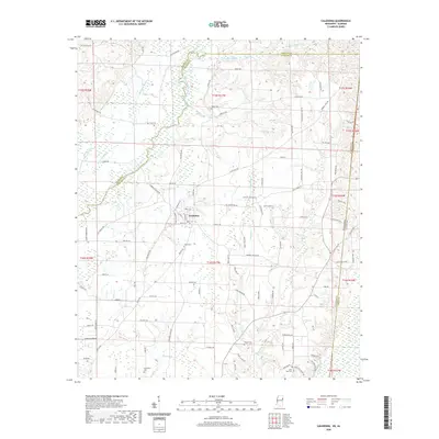
2020 Map of Caledonia
USGS Topo · Published 2020About this map
Caledonia serves as the primary settlement center within this borderland landscape, situated where the rural road networks of Lowndes County converge. The town's grid, including Main St and Academy St, transitions into a terrain defined by the winding course of the Buttahatchee River and its numerous tributaries such as Honnoll Mill Cr and Bluff Cr. This 2020 survey illustrates a quiet agricultural and residential region marked by scattered family and community sites, including Unity Cem and Rowan Cem. To the west, the landscape softens into low-lying areas near Running Slough and Maple Br, while the eastern edge follows the Mississippi Alabama state line. Small-scale place names like Sturdivant and landmarks such as Quail Ridge provide a clear view of the modern rural character of this region northeast of Columbus.
Find a feature on this map
98 named features on this map. Tap any name to fly to it.
Don’t see what you’re looking for? This feature index may not catch every label — zoom into the map to look around manually.
Map Details
Editions of this 2020 Caledonia Map
This is the sole edition of this map. No revisions or reprints were ever made.
Other maps of this area

1953 · West Point
USGS Topo · 1:250,000

1958 · West Point
USGS Topo · 1:250,000

1960 · Caledonia
USGS Topo · 1:62,500

1963 · West Point
USGS Topo · 1:250,000

1966 · Amory SW
USGS Topo · 1:24,000

1966 · Amory SE
USGS Topo · 1:24,000

1967 · Sulligent SW
USGS Topo · 1:24,000

1967 · Millport NW
USGS Topo · 1:24,000

1967 · Fernbank
USGS Topo · 1:24,000

1982 · West Point
USGS Topo · 1:100,000