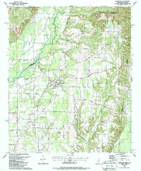
1987 Map of Caledonia
USGS Topo · Published 1987About this map
Caledonia serves as the central hub of this late 20th-century landscape, situated along the Mississippi and Alabama border. The town is surrounded by a dense network of country roads including Old Wolf Road and Caledonia-Vernon Road, which connect numerous local institutions. Small communities and family congregations are evident through landmarks like Bethlehem Ch, Brown Lee Ch, and the Military Chapel Cem in the south.
Find a feature on this map
51 named features on this map. Tap any name to fly to it.
Don’t see what you’re looking for? This feature index may not catch every label — zoom into the map to look around manually.
Map Details
Editions of this 1987 Caledonia Map
This is the sole edition of this map. No revisions or reprints were ever made.
Other maps of this area

1953 · West Point
USGS Topo · 1:250,000

1958 · West Point
USGS Topo · 1:250,000

1960 · Caledonia
USGS Topo · 1:62,500

1963 · West Point
USGS Topo · 1:250,000

1966 · Amory SW
USGS Topo · 1:24,000

1966 · Amory SE
USGS Topo · 1:24,000

1967 · Sulligent SW
USGS Topo · 1:24,000

1967 · Millport NW
USGS Topo · 1:24,000

1967 · Fernbank
USGS Topo · 1:24,000

1982 · West Point
USGS Topo · 1:100,000