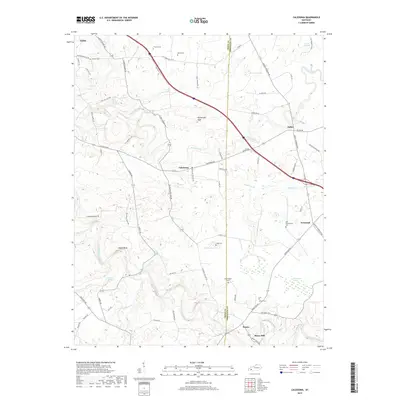
2019 Map of Caledonia
USGS Topo · Published 2019About this map
The Trigg Co Christian Co line bisects this landscape, marking a rural territory where agriculture and hydrology define the community structure. The settlement of Caledonia sits at a central crossroads, while other small hamlets like Peedee and Newstead dot the eastern and southern reaches. Water is a dominant force here, from the meandering path of the Little River to unique features like Boatwright Hole and the wetland expanse of McGaughey Swamp. Family history is deeply rooted in the land, evidenced by numerous burial grounds including Stewart Cem, Thomas Cem, and the Old Presbyterian Cem. The presence of Binns Mill near the southern boundary suggests a legacy of local processing along the river, while natural springs like Coon Cave Spring and Garrett Spring indicate the area's karst-influenced terrain. In the northwest, the edge of Cadiz appears, linking this agrarian zone to the larger county seat.
Find a feature on this map
74 named features on this map. Tap any name to fly to it.
Don’t see what you’re looking for? This feature index may not catch every label — zoom into the map to look around manually.
Map Details
Editions of this 2019 Caledonia Map
This is the sole edition of this map. No revisions or reprints were ever made.
Other maps of this area

1950 · Caledonia
USGS Topo · 1:24,000

1951 · Church Hill
USGS Topo · 1:24,000

1951 · Caledonia
USGS Topo · 1:24,000

1951 · Roaring Spring
USGS Topo · 1:24,000

1951 · Johnson Hollow
USGS Topo · 1:24,000

1951 · Herndon
USGS Topo · 1:24,000

1952 · Pleasant Green Hill
USGS Topo · 1:24,000

1953 · Gracey
USGS Topo · 1:24,000

1953 · Cobb
USGS Topo · 1:24,000
1953 · Cadiz
USGS Topo · 1:24,000