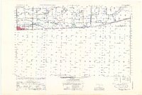
1953 Map of Calexico
USGS Topo · Published 1953About this map
Calexico anchors the international border in the Imperial Valley during the early 1950s, serving as a gateway between the United States and Mexico. This survey reveals an incredibly sophisticated irrigation and drainage network essential for desert agriculture, dominated by the massive All American Canal and the meandering Alamo River. The landscape is a geometric grid of canals, drains, and laterals, including the Central Main Canal, Beech Canal, and East Highline Canal. Local rural life is evidenced by the placement of the Jasper Sch and Verde Sch, alongside the small crossroads of Bonds Corner. A striking detail of the map is the abrupt transition from the developed, water-managed American side to the largely unmapped territory across the California and Baja California border, illustrating the stark boundary between the two nations' different development patterns at mid-century.
Find a feature on this map
25 named features on this map. Tap any name to fly to it.
Don’t see what you’re looking for? This feature index may not catch every label — zoom into the map to look around manually.
Map Details
Editions of this 1953 Calexico Map
This is the sole edition of this map. No revisions or reprints were ever made.
Other maps of this area

1907 · Holtville
USGS Topo · 1:125,000

1915 · El Centro
USGS Topo · 1:125,000

1940 · Brawley
USGS Topo · 1:62,500

1940 · Heber
USGS Topo · 1:62,500

1940 · Alamorio
USGS Topo · 1:62,500

1940 · Calexico
USGS Topo · 1:62,500

1942 · El Centro
USGS Topo · 1:250,000

1943 · Heber
USGS Topo · 1:62,500

1943 · Brawley
USGS Topo · 1:62,500

1943 · Calexico
USGS Topo · 1:62,500