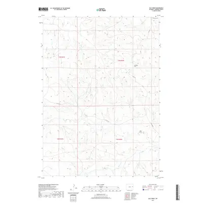
2017 Map of Calf Draw
USGS Topo · Published 2017About this map
Dixon Ranch sits within a landscape defined by the drainage systems of Cow Creek and Bull Creek in Niobrara County. This 2017 survey illustrates the intricate network of natural draws and seasonal waterways that characterize this part of Wyoming, including the namesake Calf Draw and the descriptively named Hooligan Draw. The map details the rural infrastructure connecting these ranch lands, such as Cow Creek Rd and Slagle Rd, which follow the natural contours of the terrain. The presence of Mercer Draw and several branches of Middle Creek shows the complex hydrology of the high plains. For those interested in land use and water rights, the clear demarcation of township and range lines, such as t39n r66w, provides a precise framework for locating specific historical property and ranching operations.
Find a feature on this map
18 named features on this map. Tap any name to fly to it.
Don’t see what you’re looking for? This feature index may not catch every label — zoom into the map to look around manually.
Map Details
Editions of this 2017 Calf Draw Map
This is the sole edition of this map. No revisions or reprints were ever made.
Other maps of this area

1955 · Newcastle
USGS Topo · 1:250,000

1958 · Newcastle
USGS Topo · 1:250,000

1981 · Calf Draw
USGS Topo · 1:24,000
1981 · Wagonhound Creek
USGS Topo · 1:24,000

1981 · Mercer Draw
USGS Topo · 1:24,000

1981 · Pinnacle Rocks
USGS Topo · 1:24,000

1981 · Dixon Ranch
USGS Topo · 1:24,000

1981 · Lance Creek NW
USGS Topo · 1:24,000

1981 · Garland Draw
USGS Topo · 1:24,000

1981 · Wagonhound Creek NE
USGS Topo · 1:24,000