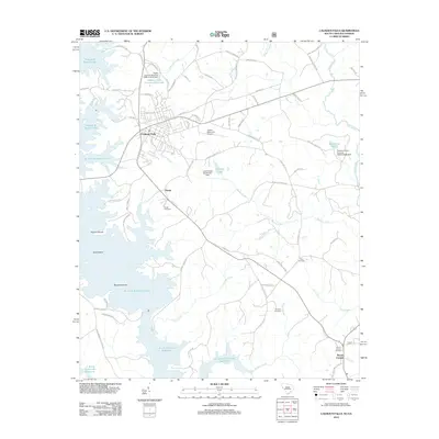
2012 Map of Calhoun Falls
USGS Topo · Published 2012About this map
Calhoun Falls serves as the primary hub in this corner of Abbeville County, where the landscape is defined by the massive reach of Richard B Russell Lake and the J. Strom Thurmond Reservoir. The map reveals a transition from the town's street grid into the surrounding rural tracts and protected lands like Calhoun Falls State Park. Family history is anchored in the countryside by several burial grounds, including Hester Cemetery, Boyd Cemetery, and Brough Cemetery. Water dominates the southern and western portions of the quadrangle, where former land features like Trotters Shoals and Goat Island are now part of a large-scale hydroelectric and recreational basin. Small aviation history is represented by the Hester Memorial Airport, located just east of the main settlement at Hester.
Find a feature on this map
70 named features on this map. Tap any name to fly to it.
Don’t see what you’re looking for? This feature index may not catch every label — zoom into the map to look around manually.
Map Details
Editions of this 2012 Calhoun Falls Map
This is the sole edition of this map. No revisions or reprints were ever made.
Other maps of this area

1892 · Mc Cormick
USGS Topo · 1:125,000

1892 · Abbeville
USGS Topo · 1:125,000

1893 · Elberton
USGS Topo · 1:125,000

1906 · Crawfordville
USGS Topo · 1:125,000

1912 · Mc Cormick
USGS Topo · 1:125,000

1948 · Abbeville West
USGS Topo · 1:24,000

1949 · Abbeville
USGS Topo · 1:24,000

1949 · Calhoun Creek
USGS Topo · 1:24,000

1953 · Athens
USGS Topo · 1:250,000

1954 · Greenville
USGS Topo · 1:250,000