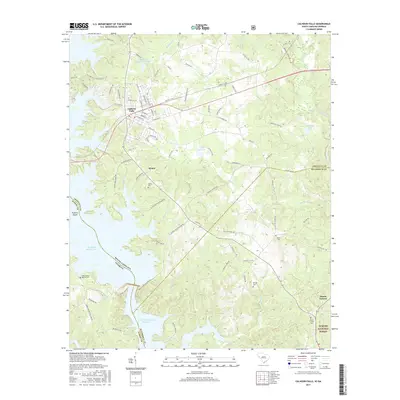
2017 Map of Calhoun Falls
USGS Topo · Published 2017About this map
Calhoun Falls serves as the focal point of this western South Carolina landscape, situated where the CSX Transportation line crosses a region defined by its complex waterways and the state border with Georgia. The map documents a hybrid landscape of managed timberlands and significant hydroelectric projects, with the massive Richard B Russell Lake and the J. Strom Thurmond Reservoir dominating the southern half of the quadrangle. For those researching local history, the map preserves the locations of several community landmarks like Hester and Mount Carmel, alongside scattered family and congregational burial sites such as Tates Grove Baptist Cem and Boyd Cem. The presence of Trotters Shoals along the Savannah River channel highlights the area's geological character before modern inundation, while the Sumter National Forest boundary indicates the extent of public land conservation in the eastern reaches of the sheet.
Find a feature on this map
93 named features on this map. Tap any name to fly to it.
Don’t see what you’re looking for? This feature index may not catch every label — zoom into the map to look around manually.
Map Details
Editions of this 2017 Calhoun Falls Map
This is the sole edition of this map. No revisions or reprints were ever made.
Other maps of this area

1892 · Mc Cormick
USGS Topo · 1:125,000

1892 · Abbeville
USGS Topo · 1:125,000

1893 · Elberton
USGS Topo · 1:125,000

1906 · Crawfordville
USGS Topo · 1:125,000

1912 · Mc Cormick
USGS Topo · 1:125,000

1948 · Abbeville West
USGS Topo · 1:24,000

1949 · Abbeville
USGS Topo · 1:24,000

1949 · Calhoun Creek
USGS Topo · 1:24,000

1953 · Athens
USGS Topo · 1:250,000

1954 · Greenville
USGS Topo · 1:250,000