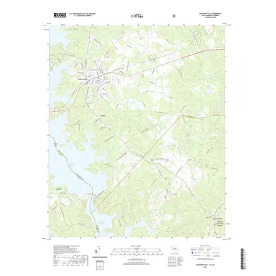
2020 Map of Calhoun Falls
USGS Topo · Published 2020About this map
Calhoun Falls serves as the primary hub in this South Carolina-Georgia borderland, where the landscape is defined by the massive reservoirs of the Savannah River basin. The town's grid transitions into the surrounding rural landscape of Abbeville County, leading toward the smaller communities of Hester and Mount Carmel. Large-scale water features like Richard B Russell Lake and the northern reaches of the J. Strom Thurmond Reservoir dominate the western and southern boundaries, illustrating the 20th-century transformation of the river valley. Genealogists and local historians can locate several rural burial sites, including Tates Grove Baptist Cem, Boyd Cem, and Brough Cem. The eastern portion of the map covers the wooded expanse of the Sumter National Forest, while various creeks such as McKenley Cr and Sawney Cr drain the remaining uplands. This contemporary survey preserves the modern names of early crossroads and the enduring footprints of family cemeteries.
Find a feature on this map
99 named features on this map. Tap any name to fly to it.
Don’t see what you’re looking for? This feature index may not catch every label — zoom into the map to look around manually.
Map Details
Editions of this 2020 Calhoun Falls Map
This is the sole edition of this map. No revisions or reprints were ever made.
Other maps of this area

1892 · Mc Cormick
USGS Topo · 1:125,000

1892 · Abbeville
USGS Topo · 1:125,000

1893 · Elberton
USGS Topo · 1:125,000

1906 · Crawfordville
USGS Topo · 1:125,000

1912 · Mc Cormick
USGS Topo · 1:125,000

1948 · Abbeville West
USGS Topo · 1:24,000

1949 · Abbeville
USGS Topo · 1:24,000

1949 · Calhoun Creek
USGS Topo · 1:24,000

1953 · Athens
USGS Topo · 1:250,000

1954 · Greenville
USGS Topo · 1:250,000