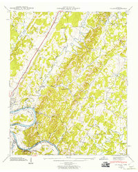
1943 Map of Calhoun
USGS Topo · Published 1960About this map
Calhoun sits at a strategic crossing of the Hiwassee River and the Southern railroad in this 1943 field-examined survey. The landscape is defined by the broad curves of the river, including Bates Bend and the Chickamauga Reservoir backwaters, which dominate the southwestern corner. Higher ground is marked by prominent ridges such as Getty Ridge and isolated peaks like Swafford Knob, where a network of rural churches and cemeteries, including Britton Ch and the Womack Cem, served established farming communities.
Find a feature on this map
50 named features on this map. Tap any name to fly to it.
Don’t see what you’re looking for? This feature index may not catch every label — zoom into the map to look around manually.
Map Details
Editions of this 1943 Calhoun Map
2 editions found
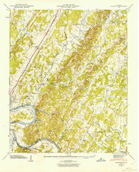
Other maps of this area

1886 · Cleveland
USGS Topo · 1:125,000

1892 · Cleveland
USGS Topo · 1:125,000

1895 · Cleveland
USGS Topo · 1:125,000

1901 · Cleveland
USGS Topo · 1:125,000

1935 · East Cleveland
USGS Topo · 1:24,000

1935 · Calhoun
USGS Topo · 1:24,000

1935 · Benton
USGS Topo · 1:24,000

1935 · Athens
USGS Topo · 1:24,000

1935 · Goodfield
USGS Topo · 1:24,000

1935 · Charleston
USGS Topo · 1:24,000