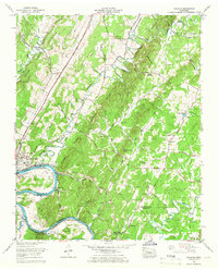
1964 Map of Calhoun
USGS Topo · Published 1966About this map
The Hiwassee River defines the southern reach of this landscape, where the waters of Chickamauga Lake meet the banks of Charleston and Calhoun. This mid-century survey reveals a settled ridge-and-valley corridor dominated by the Southern and Louisville and Nashville railroads. The map captures a high density of rural institutions, including the Calhoun Sch and Waldrop Store, alongside numerous neighborhood houses of worship such as Eastanallee Ch and Walnut Grove Ch.
Find a feature on this map
65 named features on this map. Tap any name to fly to it.
Don’t see what you’re looking for? This feature index may not catch every label — zoom into the map to look around manually.
Map Details
Editions of this 1964 Calhoun Map
2 editions found
Other maps of this area

1886 · Cleveland
USGS Topo · 1:125,000

1892 · Cleveland
USGS Topo · 1:125,000

1895 · Cleveland
USGS Topo · 1:125,000

1901 · Cleveland
USGS Topo · 1:125,000

1935 · East Cleveland
USGS Topo · 1:24,000

1935 · Calhoun
USGS Topo · 1:24,000

1935 · Benton
USGS Topo · 1:24,000

1935 · Athens
USGS Topo · 1:24,000

1935 · Goodfield
USGS Topo · 1:24,000

1935 · Charleston
USGS Topo · 1:24,000