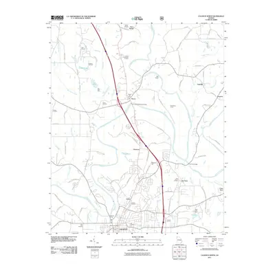
2011 Map of Calhoun North
USGS Topo · Published 2011About this map
Calhoun sits at the southern edge of this map, serving as a hub where the Oostanaula River meets the local transport network. The landscape is defined by the convergence of major waterways, including the Conasauga River and the Coosawattee River, which wind through the terrain to form the Oostanaula. Significant historical sites are concentrated near Resaca, including the Resaca Confederate Cemetery, a landmark tied to the area's Civil War legacy.
Find a feature on this map
93 named features on this map. Tap any name to fly to it.
Don’t see what you’re looking for? This feature index may not catch every label — zoom into the map to look around manually.
Map Details
Editions of this 2011 Calhoun North Map
This is the sole edition of this map. No revisions or reprints were ever made.
Other maps of this area

1886 · Dalton
USGS Topo · 1:125,000

1886 · Ringgold
USGS Topo · 1:125,000

1886 · Rome
USGS Topo · 1:125,000

1890 · Cartersville
USGS Topo · 1:125,000

1891 · Cartersville
USGS Topo · 1:125,000

1892 · Ringgold
USGS Topo · 1:125,000

1892 · Dalton
USGS Topo · 1:125,000

1896 · Cartersville
USGS Topo · 1:125,000

1897 · Dalton
USGS Topo · 1:125,000

1898 · Rome
USGS Topo · 1:125,000