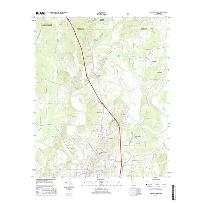
2017 Map of Calhoun North
USGS Topo · Published 2017About this map
The Oostanaula River and Conasauga River converge near Resaca, a region deeply marked by its heritage and river-valley geography. This modern survey shows the intricate intersection of transportation and preservation, featuring the CSX Transportation line and the Clem Holland Memorial Bridge. Genealogists and local researchers can identify numerous burial sites across the landscape, including the Resaca Confederate Cem, New Echota Cem, and Nance Springs Cem. The northern portion of the map transitions into the Chattahoochee National Forest at the Whitfield Co border, while the southern section encompasses the city of Calhoun and the historic area of Echota. Small settlements like Soapstick and Damascus dot the terrain between the primary river bends and hills.
Find a feature on this map
141 named features on this map. Tap any name to fly to it.
Don’t see what you’re looking for? This feature index may not catch every label — zoom into the map to look around manually.
Map Details
Editions of this 2017 Calhoun North Map
This is the sole edition of this map. No revisions or reprints were ever made.
Other maps of this area

1886 · Dalton
USGS Topo · 1:125,000

1886 · Ringgold
USGS Topo · 1:125,000

1886 · Rome
USGS Topo · 1:125,000

1890 · Cartersville
USGS Topo · 1:125,000

1891 · Cartersville
USGS Topo · 1:125,000

1892 · Ringgold
USGS Topo · 1:125,000

1892 · Dalton
USGS Topo · 1:125,000

1896 · Cartersville
USGS Topo · 1:125,000

1897 · Dalton
USGS Topo · 1:125,000

1898 · Rome
USGS Topo · 1:125,000