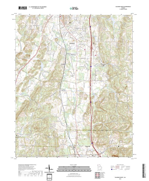
2024 Map of Calhoun South
USGS Topo · Published 2024About this map
Adairsville and Calhoun anchor this survey of the North Georgia corridor, where the land transitions from the valley of the Oostanaula River into the rising ridges of John Gunn Mountain and Iron Mtn. The landscape is defined by the winding course of Oothkalooga Creek, which drains much of the central valley between the two main settlements. This corridor shows a distinct pattern of small agricultural communities like Lily Pond and McDaniels that have long relied on the fertile bottomlands and natural springs.
Find a feature on this map
185 named features on this map. Tap any name to fly to it.
Don’t see what you’re looking for? This feature index may not catch every label — zoom into the map to look around manually.
Map Details
Editions of this 2024 Calhoun South Map
This is the sole edition of this map. No revisions or reprints were ever made.
Other maps of this area

1886 · Dalton
USGS Topo · 1:125,000

1886 · Ringgold
USGS Topo · 1:125,000

1886 · Rome
USGS Topo · 1:125,000

1890 · Cartersville
USGS Topo · 1:125,000

1891 · Cartersville
USGS Topo · 1:125,000

1892 · Ringgold
USGS Topo · 1:125,000

1892 · Dalton
USGS Topo · 1:125,000

1896 · Cartersville
USGS Topo · 1:125,000

1897 · Dalton
USGS Topo · 1:125,000

1898 · Rome
USGS Topo · 1:125,000