
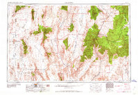
1959 Map of Caliente
USGS Topo · Published 1959About this map
Pioche and the surrounding mining districts anchor this mid-century look at Lincoln County, a landscape defined by sharp mountain ranges and vast desert basins. The industrial footprint of the era is evident at the Bristol Silver Mine and Black Metal Mine, while the Union Pacific railroad cuts through the terrain to serve Caliente and Panaca. To the west, the Las Vegas Bombing and Gunnery Range occupies a massive portion of the basin floor near Groom Lake, marking the Cold War military presence in the region.
Find a feature on this map
62 named features on this map. Tap any name to fly to it.
Don’t see what you’re looking for? This feature index may not catch every label — zoom into the map to look around manually.
Map Details
Editions of this 1959 Caliente Map
2 editions found
Other maps of this area

1885 · St. George
USGS Topo · 1:250,000

1885 · Pioche
USGS Topo · 1:250,000

1886 · Saint Thomas
USGS Topo · 1:250,000

1886 · Mt. Trumbull
USGS Topo · 1:250,000

1886 · Pioche
USGS Topo · 1:250,000

1891 · St. George
USGS Topo · 1:250,000

1892 · Mt. Trumbull
USGS Topo · 1:250,000

1893 · Saint Thomas
USGS Topo · 1:250,000

1907 · Las Vegas
USGS Topo · 1:250,000

1908 · Kawich
USGS Topo · 1:250,000