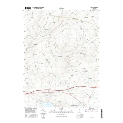
2016 Map of Califon
USGS Topo · Published 2016About this map
South Branch Raritan River anchors this landscape, flowing through a series of valley settlements including Vernoy, Lower Valley, and the borough of Califon. This modern survey illustrates the enduring rural character of the Hunterdon and Morris County border, where historic churchyards and cemeteries remain central landmarks. Locations like the Fairmount Presbyterian Church Yard and Cokesbury Methodist Church Yard provide specific points of reference for genealogists. To the south, the massive Round Valley Reservoir and nearby Cushetunk Lake dominate the geography, contrasted by the sharp rise of Hell Mtn and Cushetunk Mtn. The transport network reveals a mix of older routes like Co Rd 513 and the developed corridor near Lebanon and White House Station, while legacy sites such as McCrea Mills and Bissell point to the area's agricultural and milling roots.
Find a feature on this map
195 named features on this map. Tap any name to fly to it.
Don’t see what you’re looking for? This feature index may not catch every label — zoom into the map to look around manually.
Map Details
Editions of this 2016 Califon Map
This is the sole edition of this map. No revisions or reprints were ever made.
Other maps of this area

1888 · Hackettstown
USGS Topo · 1:62,500

1888 · Lake Hopatcong
USGS Topo · 1:62,500

1890 · High Bridge
USGS Topo · 1:62,500

1891 · Somerville
USGS Topo · 1:62,500

1893 · Somerville
USGS Topo · 1:62,500

1894 · Hackettstown
USGS Topo · 1:62,500

1894 · Lake Hopatcong
USGS Topo · 1:62,500

1898 · Lake Hopatcong
USGS Topo · 1:62,500

1898 · Hackettstown
USGS Topo · 1:62,500

1898 · High Bridge
USGS Topo · 1:62,500