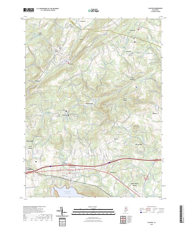
2023 Map of Califon
USGS Topo · Published 2023About this map
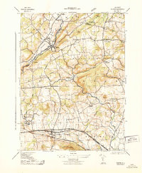
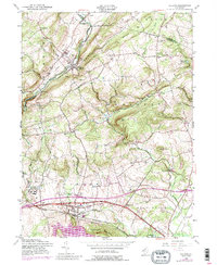
The South Branch Raritan River carves a path through this part of Hunterdon and Morris Counties, anchoring the historical settlement of Califon and nearby Lower Valley. The landscape is defined by the prominent Fox Hill Range to the north and the rising elevations of Hell Mtn and Cushetunk Mtn further south. Local genealogy and community life are well-documented through numerous religious landmarks, including the Lower Valley Presbyterian Church Cemetery and the Fairmount Methodist Church Yard.
Find a feature on this map
49 named features on this map. Tap any name to fly to it.
Don’t see what you’re looking for? This feature index may not catch every label — zoom into the map to look around manually.
Map Details
Editions of this 2023 Califon Map
This is the sole edition of this map. No revisions or reprints were ever made.
Historical Maps of Fairmount Through Time
3 maps found