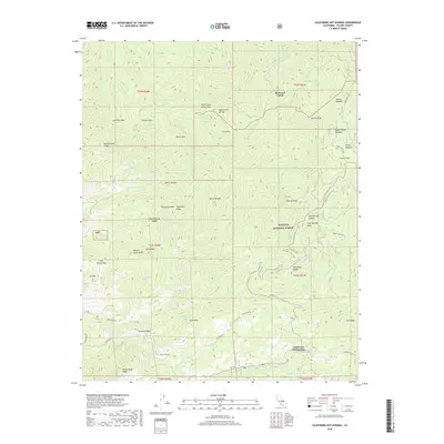
2018 Map of California Hot Springs
USGS Topo · Published 2018About this map
California Hot Springs serves as the focal point for this section of the Sequoia National Forest, where the transition from the southern Sierra Nevada foothills to higher elevations is marked by a network of seasonal creeks and named peaks. The settlement pattern is defined by remote mountain outposts such as Redwood Corral and recreational landscapes like Soldier Meadow and Upper Parker Meadow.
Find a feature on this map
68 named features on this map. Tap any name to fly to it.
Don’t see what you’re looking for? This feature index may not catch every label — zoom into the map to look around manually.
Map Details
Editions of this 2018 California Hot Springs Map
This is the sole edition of this map. No revisions or reprints were ever made.
Other maps of this area

1904 · Kaweah
USGS Topo · 1:125,000

1909 · Kaweah
USGS Topo · 1:125,000

1936 · White River
USGS Topo · 1:62,500

1936 · Tobias Peak
USGS Topo · 1:125,000

1937 · Kaweah
USGS Topo · 1:125,000

1943 · Tobias Peak
USGS Topo · 1:125,000

1945 · Tobias Peak
USGS Topo · 1:62,500

1948 · Bakersfield
USGS Topo · 1:250,000

1948 · Fresno
USGS Topo · 1:250,000
1952 · White River
USGS Topo · 1:62,500