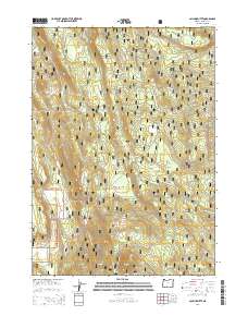
2014 Map of Calimus Butte
USGS Topo · Published 2014About this map
Calimus Butte rises as the central landmark of this landscape within the Winema National Forest of Klamath County. The terrain is defined by a dense network of forest development routes, such as Nat For Dev Rd 4550 and Nat For Dev Rd 4530, which provide access to the timbered reaches and scattered water sources that sustain the local ecology. Vital water features including North Calimus Spring and Haller Spring serve as critical points of interest in this high-elevation forest setting. In the northern portion of the map, the headwaters of Yamsay Creek emerge. The presence of Williamson River Rd suggests the historical importance of the Williamson River drainage to the region's logging and recreational infrastructure, reflecting a modern era of forest management and natural resource protection in the Oregon Cascades.
Find a feature on this map
21 named features on this map. Tap any name to fly to it.
Don’t see what you’re looking for? This feature index may not catch every label — zoom into the map to look around manually.
Map Details
Editions of this 2014 Calimus Butte Map
This is the sole edition of this map. No revisions or reprints were ever made.
Other maps of this area

1889 · Klamath
USGS Topo · 1:250,000

1894 · Klamath
USGS Topo · 1:250,000

1955 · Klamath Falls
USGS Topo · 1:250,000

1956 · Calimus Butte
USGS Topo · 1:62,500

1957 · Klamath Marsh
USGS Topo · 1:62,500

1958 · Klamath Falls
USGS Topo · 1:250,000

1960 · Fuego Mountain
USGS Topo · 1:62,500

1960 · Yamsay Mountain
USGS Topo · 1:62,500

1980 · Williamson River
USGS Topo · 1:100,000
1988 · Applegate Butte
USGS Topo · 1:24,000