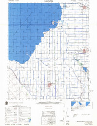
1976 Map of Calipatria
USGS Topo · Published 1976About this map
The Salton Sea dominates the northwestern portion of this 1976 survey, its shoreline defined by the Salton Sea National Wildlife Refuge and the Imperial State Wildlife Area. This landscape in the Imperial Valley is a complex grid of intensive irrigation, where the Alamo River and New River flow toward the sea amidst a dense network of canals like the Westside Main Canal and Trifolium Canal. The map captures the agricultural and industrial character of the region, featuring Carbon Dioxide Wells, geothermal indicators like the Mud Pots, and extraction sites at Obsidian Butte and Rock Hill. Settlements such as Calipatria, Westmorland, and Niland serve as hubs along the Southern Pacific rail line, illustrating the mid-century dependence on both rail transport and managed water for desert reclamation.
Find a feature on this map
40 named features on this map. Tap any name to fly to it.
Don’t see what you’re looking for? This feature index may not catch every label — zoom into the map to look around manually.
Map Details
Editions of this 1976 Calipatria Map
This is the sole edition of this map. No revisions or reprints were ever made.
Other maps of this area

1907 · Holtville
USGS Topo · 1:125,000

1915 · El Centro
USGS Topo · 1:125,000

1940 · Brawley
USGS Topo · 1:62,500

1940 · Kane Spring
USGS Topo · 1:62,500

1940 · Iris
USGS Topo · 1:62,500

1940 · Frink
USGS Topo · 1:62,500

1940 · Iris Pass
USGS Topo · 1:62,500

1940 · Plaster City
USGS Topo · 1:62,500

1940 · Alamorio
USGS Topo · 1:62,500

1940 · Durmid
USGS Topo · 1:62,500