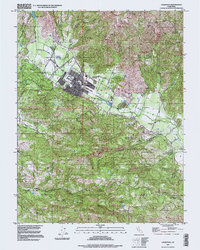
1927 Map of Calistoga
USGS Topo · Published 1936About this map
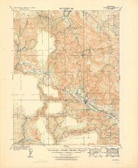
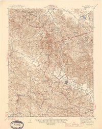
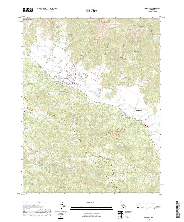
Mt St Helena dominates this 1915 survey of the northern Napa Valley region, anchoring a landscape defined by volcanic geology and early industry. To the south, the Petrified Forest offers a prehistoric counterpoint to the active mining operations scattered across the Miyakma Mountains and Howell Mountain. This area was a critical node for quicksilver production, evidenced by the Oat Hill Mine, Coronado Mine, and Mirabel Mine. The valley floor shows the infrastructure of the burgeoning wine and resort economy, centered on Callstoga. The Southern Pacific railroad line connects the town to agricultural outposts like Larkmead, Bale, and Dunaweal. Rural life is further mapped through isolated institutions such as the Alpine School and Pine Hill School, alongside family-named holdings like Langstry Ranch and Spring Hill Farm.
Find a feature on this map
33 named features on this map. Tap any name to fly to it.
Don’t see what you’re looking for? This feature index may not catch every label — zoom into the map to look around manually.
Map Details
Editions of this 1927 Calistoga Map
2 editions found

Historical Maps of Santa Rosa Through Time
11 maps found
1927 Calistoga
Napa County, CA

1943 Calistoga
Napa County, CA
1945 Calistoga
Napa County, CA
1958 Calistoga
Napa County, CA

1959 Calistoga
Napa County, CA
1993 Calistoga
Napa County, CA
1997 Calistoga
Napa County, CA
2012 Calistoga
Napa County, CA
2015 Calistoga
Napa County, CA
2018 Calistoga
Napa County, CA
2021 Calistoga
Napa County, CA