
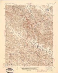
1945 Map of Calistoga
USGS Topo · Published 1945About this map
Calistoga serves as a central hub in this mid-1940s landscape, where the upper Napa River valley meets the complex geology of the Mayacamas Mountains. The map highlights a significant mining economy concentrated around the ridges, featuring numerous operations such as the Oat Hill Mine, Great Western Mine, and the Silverado Mine (Abandoned). These mineral interests are contrasted by the agricultural and educational footprints in the valleys, evidenced by small rural schoolhouses like Dunwater Sch and Riebli Sch.
Find a feature on this map
76 named features on this map. Tap any name to fly to it.
Don’t see what you’re looking for? This feature index may not catch every label — zoom into the map to look around manually.
Map Details
Editions of this 1945 Calistoga Map
2 editions found
Other maps of this area

1902 · Napa
USGS Topo · 1:125,000

1916 · Santa Rosa
USGS Topo · 1:62,500

1920 · Healdsburg
USGS Topo · 1:62,500

1921 · Kelseyville
USGS Topo · 1:62,500

1927 · Calistoga
USGS Topo · 1:62,500

1933 · Healdsburg
USGS Topo · 1:48,000

1935 · Sebastopol
USGS Topo · 1:48,000

1940 · Healdsburg
USGS Topo · 1:62,500

1942 · Sebastopol
USGS Topo · 1:62,500

1942 · Sonoma
USGS Topo · 1:62,500