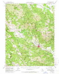
1959 Map of Calistoga
USGS Topo · Published 1966About this map
Mount St Helena dominates this mid-century landscape where the boundaries of Lake, Sonoma, and Napa counties converge. The rugged terrain is deeply marked by early industry, shown through an extensive network of mining operations such as the Oat Hill Mine, Mirabel Mine, and Corona Mine. In the valley floor, Calistoga serves as a hub for the Southern Pacific railroad, which tracks parallel to the Napa River. The map captures a transition from the industrial legacy of quicksilver and mineral extraction to the established agricultural and preservation character of the region. Distinct cultural landmarks are noted, including the Bale Mill Historical Monument and the Robert Louis Stevenson Memorial State Park, alongside indigenous territories like the Middletown Rancheria and Mark West Creek Rancheria. Water remains central to the geography, with Detert Reservoir and numerous creeks like Maacama Creek and Bidwell Creek defining the drainage patterns of the surrounding ridges.
Find a feature on this map
133 named features on this map. Tap any name to fly to it.
Don’t see what you’re looking for? This feature index may not catch every label — zoom into the map to look around manually.
Map Details
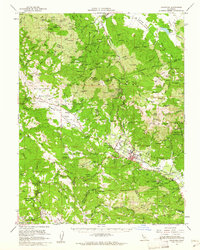
Editions of this 1959 Calistoga Map
2 editions found
Other maps of this area

1902 · Napa
USGS Topo · 1:125,000

1916 · Santa Rosa
USGS Topo · 1:62,500

1920 · Healdsburg
USGS Topo · 1:62,500

1921 · Kelseyville
USGS Topo · 1:62,500

1927 · Calistoga
USGS Topo · 1:62,500

1933 · Healdsburg
USGS Topo · 1:48,000

1935 · Sebastopol
USGS Topo · 1:48,000

1940 · Healdsburg
USGS Topo · 1:62,500

1942 · Sebastopol
USGS Topo · 1:62,500

1942 · Sonoma
USGS Topo · 1:62,500