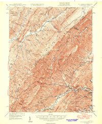
1946 Map of Callaghan
USGS Topo · Published 1946About this map
The Allegheny Mountains define the high-elevation borderlands of Virginia and West Virginia, where the Chesapeake and Ohio railroad cuts a vital path through the valleys. The settlement of Callaghan serves as a central hub along Dunlap Creek, surrounded by the expansive reaches of the George Washington National Forest and Jefferson National Forest. This mid-century survey captures a landscape of remote mountain outposts and local landmarks, including Hokes Chapel and the Hopkins Fire Tower perched above Anthony Creek. The mapping reveals the transition from industrial extraction at the Stack Mine to early recreation and community spaces like Dunlap Beach and the Boys Home. High peaks such as Peters Mountain and Batlick Mountain frame the river systems, illustrating how the rugged topography dictated the placement of schools like Whites Draft Sch and Dunlap Sch in the narrow valley corridors.
Find a feature on this map
66 named features on this map. Tap any name to fly to it.
Don’t see what you’re looking for? This feature index may not catch every label — zoom into the map to look around manually.
Map Details
Editions of this 1946 Callaghan Map
4 editions found
Other maps of this area

1887 · Lewisburg
USGS Topo · 1:125,000

1891 · Lewisburg
USGS Topo · 1:125,000

1891 · Huntersville
USGS Topo · 1:125,000

1894 · Huntersville
USGS Topo · 1:125,000

1894 · Natural Bridge
USGS Topo · 1:125,000

1901 · Monterey
USGS Topo · 1:125,000

1913 · Eagle Rock
USGS Topo · 1:48,000

1915 · Eagle Rock
USGS Topo · 1:62,500

1921 · Callaghan
USGS Topo · 1:48,000

1921 · White Sulphur Springs
USGS Topo · 1:48,000