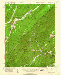
1946 Map of Callaghan
USGS Topo · Published 1962About this map
George Washington National Forest and Monongahela National Forest dominate this mid-century landscape along the border of West Virginia and Virginia. The terrain is defined by the high ridges of Lick Mountain and Middle Mtn, with the Chesapeake and Ohio railway navigating the narrow valleys between them. Local life is anchored by small settlements like Callaghan and Neola, alongside social and educational landmarks such as Hokes Chapel, the Whites Draft Sch, and the Boys Home near Covington.
Find a feature on this map
122 named features on this map. Tap any name to fly to it.
Don’t see what you’re looking for? This feature index may not catch every label — zoom into the map to look around manually.
Map Details
Editions of this 1946 Callaghan Map
4 editions found
Other maps of this area

1887 · Lewisburg
USGS Topo · 1:125,000

1891 · Lewisburg
USGS Topo · 1:125,000

1891 · Huntersville
USGS Topo · 1:125,000

1894 · Huntersville
USGS Topo · 1:125,000

1894 · Natural Bridge
USGS Topo · 1:125,000

1901 · Monterey
USGS Topo · 1:125,000

1913 · Eagle Rock
USGS Topo · 1:48,000

1915 · Eagle Rock
USGS Topo · 1:62,500

1921 · Callaghan
USGS Topo · 1:48,000

1921 · White Sulphur Springs
USGS Topo · 1:48,000