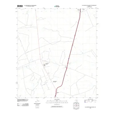
2010 Map of Callaghan Ranch South
USGS Topo · Published 2010About this map
Callaghan Ranch and the surrounding rangeland of Webb County define this South Texas landscape in the early 21st century. The geography is marked by the development of several colonias, including Four Points Colonia, Sunset Acres Colonia, and Los Veteranos 83 Colonia, reflecting the region's specific patterns of rural residential growth. These settlements are linked by a network of local roads such as San Juan Rd and Pearson-Moss Ln, which cut across the brush country toward the Interstate 35 corridor. Several ephemeral watercourses, most notably Carrizitos Creek and Tejones Creek, provide the primary drainage for the area. Smaller communities like Webb and Botines serve as central points along the transportation arteries that connect this ranching territory to the larger hubs of the Rio Grande Valley.
Find a feature on this map
18 named features on this map. Tap any name to fly to it.
Don’t see what you’re looking for? This feature index may not catch every label — zoom into the map to look around manually.
Map Details
Editions of this 2010 Callaghan Ranch South Map
This is the sole edition of this map. No revisions or reprints were ever made.
Other maps of this area

1956 · Las Tiendas
USGS Topo · 1:62,500

1956 · Islitas
USGS Topo · 1:62,500

1956 · Laredo East
USGS Topo · 1:62,500

1956 · Webb
USGS Topo · 1:62,500

1956 · Laredo
USGS Topo · 1:250,000

1965 · Orvil
USGS Topo · 1:24,000

1965 · Spohn Ranch
USGS Topo · 1:24,000

1965 · Cuervo Creek
USGS Topo · 1:24,000

1965 · Cibolo Ranch
USGS Topo · 1:24,000

1965 · Nido Ranch
USGS Topo · 1:24,000
Featured Places
- Los Veteranos II, TX
- Los Veteranos 83 Colonia, TX
- Sunset Acres Colonia, TX
- Four Points Colonia, TX
- Botines, TX