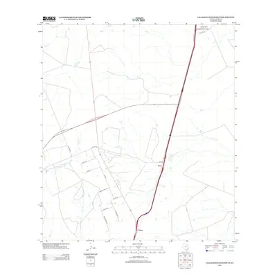
2013 Map of Callaghan Ranch South
USGS Topo · Published 2013About this map
Callaghan Ranch anchors the northern reaches of this landscape in Webb County, defined by a network of seasonal watercourses and private ranch roads. The terrain is drained by several creek systems, including Tejones Cr and the meandering Carrizitos Cr, which flow through an area largely shaped by large-scale landholdings. Small settlements such as Webb and Botines are situated along the primary transportation corridor that bisects the region, providing vital connection points in this expansive South Texas environment.
Find a feature on this map
21 named features on this map. Tap any name to fly to it.
Don’t see what you’re looking for? This feature index may not catch every label — zoom into the map to look around manually.
Map Details
Editions of this 2013 Callaghan Ranch South Map
This is the sole edition of this map. No revisions or reprints were ever made.
Other maps of this area

1956 · Las Tiendas
USGS Topo · 1:62,500

1956 · Islitas
USGS Topo · 1:62,500

1956 · Laredo East
USGS Topo · 1:62,500

1956 · Webb
USGS Topo · 1:62,500

1956 · Laredo
USGS Topo · 1:250,000

1965 · Orvil
USGS Topo · 1:24,000

1965 · Spohn Ranch
USGS Topo · 1:24,000

1965 · Cuervo Creek
USGS Topo · 1:24,000

1965 · Cibolo Ranch
USGS Topo · 1:24,000

1965 · Nido Ranch
USGS Topo · 1:24,000
Featured Places
- Los Veteranos II, TX
- Los Veteranos 83 Colonia, TX
- Sunset Acres Colonia, TX
- Four Points Colonia, TX
- Botines, TX