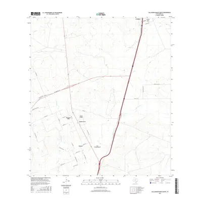
2016 Map of Callaghan Ranch South
USGS Topo · Published 2016About this map
Callaghan and its surrounding ranchlands are defined by a network of seasonal watercourses and evolving settlements north of Laredo. The landscape is carved by the ephemeral paths of Tejones Cr and Sombrerito Cr, which drain the arid terrain toward the south. The 2016 survey documents a pattern of rural residential growth with several named developments appearing along the corridor of 83. Neighborhoods like Bonanza Hills, Sunset Acres, and Los Veteranos II are clearly delineated, showing the subdivision of historic ranch properties into more modern residential tracts. Infrastructure is anchored by the Callaghan Ranch Airport in the northeast corner, while a complex grid of roads including Columbia Toll RD and various ranch roads like Ranch RD 6176a provide access to the hinterlands between the major thoroughfares of Interstate 35 and Highway 83.
Find a feature on this map
36 named features on this map. Tap any name to fly to it.
Don’t see what you’re looking for? This feature index may not catch every label — zoom into the map to look around manually.
Map Details
Editions of this 2016 Callaghan Ranch South Map
This is the sole edition of this map. No revisions or reprints were ever made.
Other maps of this area

1956 · Las Tiendas
USGS Topo · 1:62,500

1956 · Islitas
USGS Topo · 1:62,500

1956 · Laredo East
USGS Topo · 1:62,500

1956 · Webb
USGS Topo · 1:62,500

1956 · Laredo
USGS Topo · 1:250,000

1965 · Orvil
USGS Topo · 1:24,000

1965 · Spohn Ranch
USGS Topo · 1:24,000

1965 · Cuervo Creek
USGS Topo · 1:24,000

1965 · Cibolo Ranch
USGS Topo · 1:24,000

1965 · Nido Ranch
USGS Topo · 1:24,000
Featured Places
- Los Veteranos II, TX
- Los Veteranos 83 Colonia, TX
- Sunset Acres Colonia, TX
- Four Points Colonia, TX
- Botines, TX