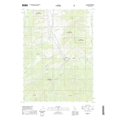
2022 Map of Callahan
USGS Topo · Published 2022About this map
Callahan serves as the focal point of this Siskiyou County landscape, situated at the junction of the Scott River forks. This settlement, a historic hub for the surrounding mountain and valley territories, is documented alongside local burial grounds including the Callahan Protestant Cem, Callahan Catholic Cem, and Callahan Hayden Cem. The map illustrates a complex drainage system feeding the river, with Wolf Cr, Wildcat Cr, and Sugar Cr carving through the terrain.
Find a feature on this map
56 named features on this map. Tap any name to fly to it.
Don’t see what you’re looking for? This feature index may not catch every label — zoom into the map to look around manually.
Map Details
Editions of this 2022 Callahan Map
This is the sole edition of this map. No revisions or reprints were ever made.
Other maps of this area

1886 · Shasta
USGS Topo · 1:250,000

1894 · Shasta
USGS Topo · 1:250,000

1923 · Sawyers Bar
USGS Topo · 1:125,000

1931 · Etna
USGS Topo · 1:96,000

1934 · Etna
USGS Topo · 1:125,000

1948 · Weed
USGS Topo · 1:250,000

1950 · Weed
USGS Topo · 1:250,000
1955 · Bonanza King
USGS Topo · 1:62,500
1955 · China Mountain
USGS Topo · 1:62,500

1955 · Etna
USGS Topo · 1:62,500