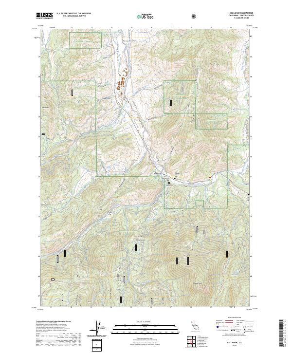
2023 Map of Callahan
USGS Topo · Published 2023About this map
The settlement of Callahan sits at the confluence of the South Fork Scott River and the East Fork Scott River, serving as a central point for this high-altitude landscape. The map reveals a cluster of burial sites nearby, including the Callahan Protestant Cem, Callahan Catholic Cem, and Callahan Hayden Cem, which highlight the area's established community history. Much of the surrounding territory is managed as part of the Klamath National Forest, rising to significant heights at Craggy Peak and along the McKeen Divide.
Find a feature on this map
56 named features on this map. Tap any name to fly to it.
Don’t see what you’re looking for? This feature index may not catch every label — zoom into the map to look around manually.
Map Details
Editions of this 2023 Callahan Map
This is the sole edition of this map. No revisions or reprints were ever made.
Other maps of this area

1886 · Shasta
USGS Topo · 1:250,000

1894 · Shasta
USGS Topo · 1:250,000

1923 · Sawyers Bar
USGS Topo · 1:125,000

1931 · Etna
USGS Topo · 1:96,000

1934 · Etna
USGS Topo · 1:125,000

1948 · Weed
USGS Topo · 1:250,000

1950 · Weed
USGS Topo · 1:250,000
1955 · Bonanza King
USGS Topo · 1:62,500
1955 · China Mountain
USGS Topo · 1:62,500

1955 · Etna
USGS Topo · 1:62,500