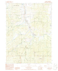
1986 Map of Callahan
USGS Topo · Published 1986About this map
Callahan serves as the primary settlement on this mid-1980s survey, situated at the confluence of the Scott River and its East Fork. The landscape is dominated by the steep terrain of the Klamath National Forest, where resource extraction and forest management are clearly visible. Extensive Tailings and various Prospect sites along the riverbanks indicate a history of alluvial mining, while the McKeen Mine and Blue Mine suggest more concentrated lode operations in the surrounding hills. A Forest Service Station and the Bolivar Lookout atop a high ridge reflect the region's mid-century infrastructure for fire observation and wilderness oversight. The map also records several family-named landmarks and geographic features such as Hayden Ridge and Noyes Valley Creek, providing a detailed look at the rural northern California interior before many of these specialized mountain facilities were modernized or decommissioned.
Find a feature on this map
50 named features on this map. Tap any name to fly to it.
Don’t see what you’re looking for? This feature index may not catch every label — zoom into the map to look around manually.
Map Details
Editions of this 1986 Callahan Map
This is the sole edition of this map. No revisions or reprints were ever made.
Other maps of this area

1886 · Shasta
USGS Topo · 1:250,000

1894 · Shasta
USGS Topo · 1:250,000

1923 · Sawyers Bar
USGS Topo · 1:125,000

1931 · Etna
USGS Topo · 1:96,000

1934 · Etna
USGS Topo · 1:125,000

1948 · Weed
USGS Topo · 1:250,000

1950 · Weed
USGS Topo · 1:250,000
1955 · Bonanza King
USGS Topo · 1:62,500
1955 · China Mountain
USGS Topo · 1:62,500

1955 · Etna
USGS Topo · 1:62,500