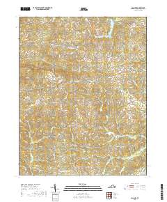
2019 Map of Callands
USGS Topo · Published 2019About this map
The Banister River and Sandy River systems dominate this portion of Pittsylvania County, shaping the rural landscape between the settlements of Callands and Rondo. Local movement historically centered on the convergence of Callands Rd and Franklin Tpke, where the small community of Callands is situated. The terrain is marked by significant topographical features such as Brier Mtn and numerous drainages like Wet Sleeve Cr and Sailor Cr.
Find a feature on this map
81 named features on this map. Tap any name to fly to it.
Don’t see what you’re looking for? This feature index may not catch every label — zoom into the map to look around manually.
Map Details
Editions of this 2019 Callands Map
This is the sole edition of this map. No revisions or reprints were ever made.
Other maps of this area

1921 · Chatham
USGS Topo · 1:48,000

1922 · Callands
USGS Topo · 1:48,000

1923 · Danville
USGS Topo · 1:48,000

1923 · Chatham
USGS Topo · 1:62,500

1924 · Draper
USGS Topo · 1:48,000

1924 · Callands
USGS Topo · 1:62,500

1925 · Danville
USGS Topo · 1:62,500

1926 · Draper
USGS Topo · 1:62,500

1944 · Draper
USGS Topo · 1:62,500

1944 · Callands
USGS Topo · 1:62,500