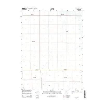
2014 Map of Callao NE
USGS Topo · Published 2014About this map
The Great Salt Lake Desert dominates the landscape of this region along the border of Tooele Co and Juab Co. This 2014 survey captures a sparsely populated and arid section of western Utah, defined primarily by its expansive basin and the subtle drainage patterns that characterize the desert floor. In the southeastern portion of the map, Fish Wash cuts through the terrain, illustrating the intermittent watercourses that are vital to understanding the local topography. The map illustrates the structured division of the land through the Public Land Survey System, showing several townships including t10s r15w and t11s r16w. This detail is particularly valuable for those researching land ownership or early 21st-century environmental data in one of Utah's most remote environments.
Find a feature on this map
10 named features on this map. Tap any name to fly to it.
Don’t see what you’re looking for? This feature index may not catch every label — zoom into the map to look around manually.
Map Details
Editions of this 2014 Callao NE Map
This is the sole edition of this map. No revisions or reprints were ever made.
Other maps of this area

1908 · Fish Springs
USGS Topo · 1:250,000

1910 · Fish Springs
USGS Topo · 1:250,000

1953 · Tooele
USGS Topo · 1:250,000

1953 · Delta
USGS Topo · 1:250,000

1955 · Tooele
USGS Topo · 1:250,000

1958 · Delta
USGS Topo · 1:250,000

1962 · Delta
USGS Topo · 1:250,000

1967 · Fish Springs NW
USGS Topo · 1:24,000
1967 · Fish Springs SW
USGS Topo · 1:24,000

1972 · Mud Lake Reservoir
USGS Topo · 1:24,000