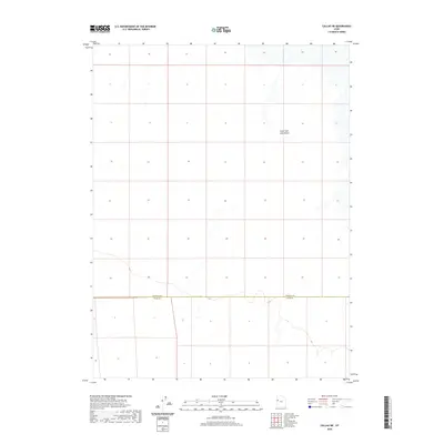
2020 Map of Callao NE
USGS Topo · Published 2020About this map
The vast, arid expanse of the Great Salt Lake Desert dominates this 2020 landscape, revealing a remote terrain defined by its stark simplicity and minimal human intervention. Situated at the convergence of the West Desert's administrative boundaries, the map clearly delineates the border between Tooele Co and Juab Co. The topography is characterized by subtle elevation changes and salt-crusted flats, typical of the region's ancient lakebed history. This survey is particularly useful for understanding the modern jurisdictional lines and the immense scale of the desert environment in a region where few roads or settlements have ever been established.
Find a feature on this map
2 named features on this map. Tap any name to fly to it.
Don’t see what you’re looking for? This feature index may not catch every label — zoom into the map to look around manually.
Map Details
Editions of this 2020 Callao NE Map
This is the sole edition of this map. No revisions or reprints were ever made.
Other maps of this area

1908 · Fish Springs
USGS Topo · 1:250,000

1910 · Fish Springs
USGS Topo · 1:250,000

1953 · Tooele
USGS Topo · 1:250,000

1953 · Delta
USGS Topo · 1:250,000

1955 · Tooele
USGS Topo · 1:250,000

1958 · Delta
USGS Topo · 1:250,000

1962 · Delta
USGS Topo · 1:250,000

1967 · Fish Springs NW
USGS Topo · 1:24,000
1967 · Fish Springs SW
USGS Topo · 1:24,000

1972 · Mud Lake Reservoir
USGS Topo · 1:24,000