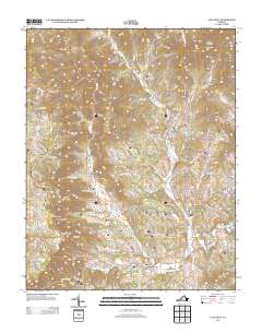
2013 Map of Callaway
USGS Topo · Published 2013About this map
Callaway sits at the junction of Ferrum Mountain Rd and Callaway Rd, serving as a central point in this part of Franklin County where the S Fork Blackwater River winds through the valley. The landscape is defined by its significant ridges and spurs, including the prominent Cahas Mountain to the northeast and the striking Devils Backbone near the Blue Ridge Pkwy.
Find a feature on this map
107 named features on this map. Tap any name to fly to it.
Don’t see what you’re looking for? This feature index may not catch every label — zoom into the map to look around manually.
Map Details
Editions of this 2013 Callaway Map
This is the sole edition of this map. No revisions or reprints were ever made.
Other maps of this area

1890 · Roanoke
USGS Topo · 1:125,000

1890 · Christiansburg
USGS Topo · 1:125,000

1891 · Roanoke
USGS Topo · 1:125,000

1925 · Rocky Mount
USGS Topo · 1:48,000

1927 · Rocky Mount
USGS Topo · 1:62,500

1944 · Rocky Mount
USGS Topo · 1:62,500

1947 · Roanoke
USGS Topo · 1:250,000

1950 · Elliston
USGS Topo · 1:62,500

1951 · Boones Mill
USGS Topo · 1:62,500

1953 · Winston-Salem
USGS Topo · 1:250,000