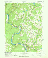
1965 Map of Callicoon
USGS Topo · Published 1973About this map
The Delaware River carves a deep horseshoe bend through this valley, serving as a natural boundary between New York and Pennsylvania. In the mid-1960s, the village of Callicoon flourished as a riverfront hub, anchored by St Josephs Seminary and St James Ch. The transportation corridor is dominated by the Erie-Lackawanna railroad, which hugs the riverbanks, supporting local industry evidenced by numerous quarries near Hawks Nest and Basket. Moving inland from the river, the landscape transitions to the elevated Long Ridge and small farming hamlets like Fremont Center and Hortonville. Local educational and religious life is well-documented, from the Delaware Valley Central Sch to the Holy Cross Cem, providing a detailed look at the social geography of Sullivan County before late-century shifts.
Find a feature on this map
52 named features on this map. Tap any name to fly to it.
Don’t see what you’re looking for? This feature index may not catch every label — zoom into the map to look around manually.
Map Details
Editions of this 1965 Callicoon Map
Other maps of this area

1920 · Long Eddy
USGS Topo · 1:62,500

1920 · Damascus
USGS Topo · 1:62,500

1921 · Long Eddy
USGS Topo · 1:48,000

1921 · Livingston Manor
USGS Topo · 1:62,500

1922 · White Lake
USGS Topo · 1:62,500

1923 · Damascus
USGS Topo · 1:62,500

1923 · Long Eddy
USGS Topo · 1:62,500

1923 · Livingston Manor
USGS Topo · 1:62,500

1942 · White Lake
USGS Topo · 1:62,500

1943 · Honesdale
USGS Topo · 1:125,000