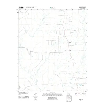
2011 Map of Calmer
USGS Topo · Published 2011About this map
Friendship and its namesake Friendship Cemetery anchor the northern landscape of this Arkansas survey, where the drainages of Brushy Creek and Big Creek carve through the Cleveland County terrain. The settlement pattern follows established routes like Smith Rd and Rowell Rd E, connecting the small communities of Calmer, Oak Grove, and Rowell. The landscape is dominated by a network of seasonal and permanent waterways, including the winding path of Kissee Creek and the southeastern waters of Kesterson Lake, which is contained by the Kesterson Lake Dam. This 2011 documentation provides a clear look at the rural intersection of agricultural land and creek-bottom forests, tracing the way local roads have developed around natural landmarks like Double Creek and Hudgens Creek.
Find a feature on this map
49 named features on this map. Tap any name to fly to it.
Don’t see what you’re looking for? This feature index may not catch every label — zoom into the map to look around manually.
Map Details
Editions of this 2011 Calmer Map
This is the sole edition of this map. No revisions or reprints were ever made.
Other maps of this area

1935 · Feenyville
USGS Topo · 1:62,500

1935 · Noble Lake
USGS Topo · 1:62,500

1948 · Helena
USGS Topo · 1:250,000

1950 · Helena
USGS Topo · 1:250,000

1953 · Greenwood
USGS Topo · 1:250,000

1953 · El Dorado
USGS Topo · 1:250,000

1955 · Helena
USGS Topo · 1:250,000

1955 · Little Rock
USGS Topo · 1:250,000

1956 · Little Rock
USGS Topo · 1:250,000

1956 · Greenwood
USGS Topo · 1:250,000