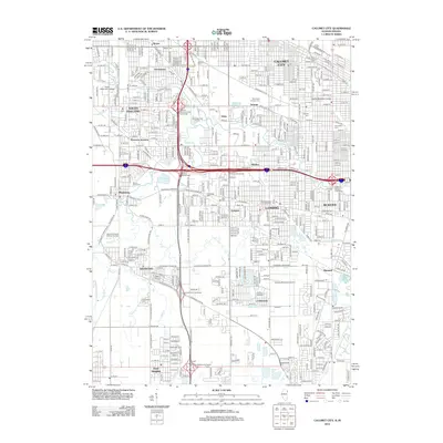
2012 Map of Calumet City
USGS Topo · Published 2012About this map
Calumet City and Lansing anchor this heavily developed corridor along the Illinois-Indiana border, where a dense network of expressways and rail lines navigates a landscape defined by historic watercourses. The Little Calumet River winds through the northern section near South Holland and South Suburban College, while Thorn Cr and Schoon Ditch drain the surrounding residential and industrial zones. This 2012 survey illustrates the complex intersection of transit and community, featuring major interchanges like the Calumet-Kingery Interchange and the specialized grounds of the Lansing Municipal Airport. Local history is preserved in numerous memorial sites, including the expansive Mount Glenwood Memory Gardens, Holy Cross Catholic Cem, and Oak Hill Cem. From the established streets of Munster to the southern neighborhoods of Lynwood and Ford Heights, the map provides a precise record of the suburban and industrial layout of the southern Chicago metropolitan area.
Find a feature on this map
48 named features on this map. Tap any name to fly to it.
Don’t see what you’re looking for? This feature index may not catch every label — zoom into the map to look around manually.
Map Details
Editions of this 2012 Calumet City Map
This is the sole edition of this map. No revisions or reprints were ever made.
Other maps of this area

1892 · Calumet
USGS Topo · 1:62,500

1893 · Calumet
USGS Topo · 1:62,500

1900 · Toleston
USGS Topo · 1:62,500

1900 · Calumet
USGS Topo · 1:62,500

1901 · Calumet
USGS Topo · 1:62,500

1929 · Calumet Lake
USGS Topo · 1:24,000

1929 · Calumet City
USGS Topo · 1:24,000
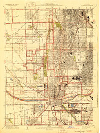
1929 · Blue Island
USGS Topo · 1:24,000

1929 · Harvey
USGS Topo · 1:24,000

1929 · Dyer
USGS Topo · 1:24,000