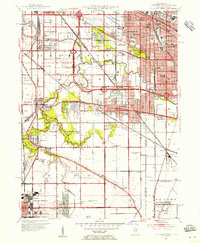
1953 Map of Calumet City
USGS Topo · Published 1955About this map
The Little Calumet River meanders across this mid-century landscape, carving a natural boundary through a region rapidly transitioning from agricultural use to dense suburban and industrial centers. Near the Illinois Indiana border, the bustling cityscapes of Calumet City and Hammond are clearly defined, showing the expansion of residential streets and educational institutions like Hammond Technical High School. Further south, the map reveals the critical aviation and communication infrastructure of the era, including the Chicago Hammond Airport and a dedicated Airway Communication Station.
Find a feature on this map
74 named features on this map. Tap any name to fly to it.
Don’t see what you’re looking for? This feature index may not catch every label — zoom into the map to look around manually.
Map Details
Editions of this 1953 Calumet City Map
This is the sole edition of this map. No revisions or reprints were ever made.
Other maps of this area

1892 · Calumet
USGS Topo · 1:62,500

1893 · Calumet
USGS Topo · 1:62,500

1900 · Toleston
USGS Topo · 1:62,500

1900 · Calumet
USGS Topo · 1:62,500

1901 · Calumet
USGS Topo · 1:62,500

1929 · Calumet Lake
USGS Topo · 1:24,000

1929 · Calumet City
USGS Topo · 1:24,000
1929 · Blue Island
USGS Topo · 1:24,000

1929 · Harvey
USGS Topo · 1:24,000

1929 · Dyer
USGS Topo · 1:24,000