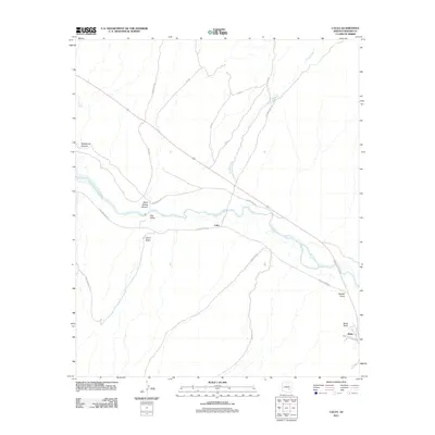
2011 Map of Calva
USGS Topo · Published 2011About this map
The Gila River corridor dominates this desert landscape, flowing through the Gila Valley near the small settlement of Calva. The topography is defined by significant drainage systems that feed toward the river, including the expansive Fivemile Wash and the distinctively named Poison Spring to the northwest. To the southeast, the community of Bylas is situated near a prominent Road Intersection, serving as a focal point for local transport at the edge of the survey area.
Find a feature on this map
26 named features on this map. Tap any name to fly to it.
Don’t see what you’re looking for? This feature index may not catch every label — zoom into the map to look around manually.
Map Details
Editions of this 2011 Calva Map
This is the sole edition of this map. No revisions or reprints were ever made.
Other maps of this area

1954 · Mesa
USGS Topo · 1:250,000

1957 · Mesa
USGS Topo · 1:250,000

1958 · Mesa
USGS Topo · 1:250,000

1960 · Mesa
USGS Topo · 1:250,000

1960 · Bylas
USGS Topo · 1:62,500

1962 · San Carlos Reservoir
USGS Topo · 1:62,500

1964 · Mesa
USGS Topo · 1:250,000

1966 · Branaman Spring
USGS Topo · 1:24,000
1966 · Ash Creek Ranch
USGS Topo · 1:24,000
1966 · Mount Triplet
USGS Topo · 1:24,000