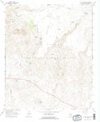
1966 Map of Mount Triplet
USGS Topo · Published 1968About this map
The San Carlos Indian Reservation dominates this 1966 topographic study, characterized by a complex network of ephemeral drainages and livestock water management. High points like Mount Triplet and Salt Mountain overlook a landscape carved by Hackberry Creek and Triplet Wash. The reliance on local hydrology is evident in the numerous named water sources, including Hackberry Spring, Willow Spring, and Salt Spring, as well as improved locations such as Saguaro Well and Double Tank. Human activity is concentrated around the Salt Creek Ranch Hdqrs in the northeast and a series of Borrow Pits and prospects that suggest small-scale material extraction. This map documents the essential infrastructure of ranching and resource management within the reservation during the mid-1960s, prior to significant modern development.
Find a feature on this map
27 named features on this map. Tap any name to fly to it.
Don’t see what you’re looking for? This feature index may not catch every label — zoom into the map to look around manually.
Map Details
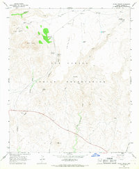
Editions of this 1966 Mount Triplet Map
2 editions found
Other maps of this area

1954 · Mesa
USGS Topo · 1:250,000

1957 · Mesa
USGS Topo · 1:250,000

1958 · Mesa
USGS Topo · 1:250,000

1960 · Mesa
USGS Topo · 1:250,000

1960 · Bylas
USGS Topo · 1:62,500

1962 · San Carlos Reservoir
USGS Topo · 1:62,500

1964 · Mesa
USGS Topo · 1:250,000

1965 · Sontag Mesa
USGS Topo · 1:24,000

1966 · Branaman Spring
USGS Topo · 1:24,000

1966 · Natural Corral
USGS Topo · 1:24,000