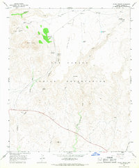
1966 Map of Mount Triplet
USGS Topo · Published 1968About this map
Antelope Flats and the high desert terrain of the San Carlos Indian Reservation characterize this mid-1960s topographic study. The landscape is defined by its water management for ranching and livestock, evidenced by numerous named tanks such as Triplets Tank, Switchback Tank, and Hackberry Tank No 1. Rising above the surrounding drainage systems, Mount Triplet and Salt Mountain serve as dominant topographical landmarks.
Find a feature on this map
30 named features on this map. Tap any name to fly to it.
Don’t see what you’re looking for? This feature index may not catch every label — zoom into the map to look around manually.
Map Details
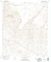
Editions of this 1966 Mount Triplet Map
2 editions found
Other maps of this area

1954 · Mesa
USGS Topo · 1:250,000

1957 · Mesa
USGS Topo · 1:250,000

1958 · Mesa
USGS Topo · 1:250,000

1960 · Mesa
USGS Topo · 1:250,000

1960 · Bylas
USGS Topo · 1:62,500

1962 · San Carlos Reservoir
USGS Topo · 1:62,500

1964 · Mesa
USGS Topo · 1:250,000

1965 · Sontag Mesa
USGS Topo · 1:24,000

1966 · Branaman Spring
USGS Topo · 1:24,000

1966 · Natural Corral
USGS Topo · 1:24,000