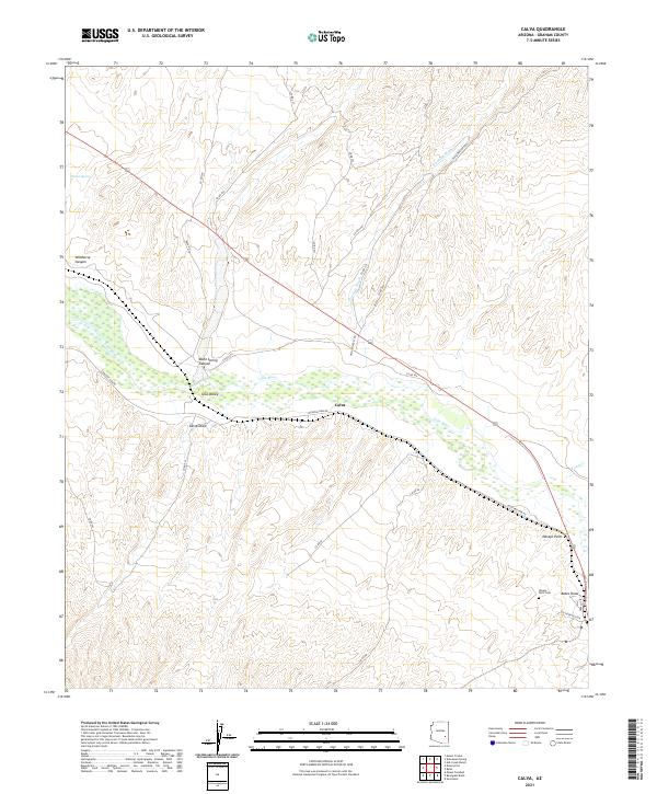
2021 Map of Calva
USGS Topo · Published 2021About this map
The Gila River flows through the heart of the Gila Valley, shaping the settlement patterns and transport routes of this Graham County landscape. Near the river's path lies Calva, a small settlement situated along Coolidge Dam Rd. The surrounding terrain is defined by drainage systems such as Fivemile Wash and Calva Draw, which intersect the higher ground to the north and south. To the east, Navajo Point stands as a notable landmark overlooking the river valley.
Find a feature on this map
35 named features on this map. Tap any name to fly to it.
Don’t see what you’re looking for? This feature index may not catch every label — zoom into the map to look around manually.
Map Details
Editions of this 2021 Calva Map
This is the sole edition of this map. No revisions or reprints were ever made.
Other maps of this area

1954 · Mesa
USGS Topo · 1:250,000

1957 · Mesa
USGS Topo · 1:250,000

1958 · Mesa
USGS Topo · 1:250,000

1960 · Mesa
USGS Topo · 1:250,000

1960 · Bylas
USGS Topo · 1:62,500

1962 · San Carlos Reservoir
USGS Topo · 1:62,500

1964 · Mesa
USGS Topo · 1:250,000

1966 · Branaman Spring
USGS Topo · 1:24,000
1966 · Ash Creek Ranch
USGS Topo · 1:24,000
1966 · Mount Triplet
USGS Topo · 1:24,000