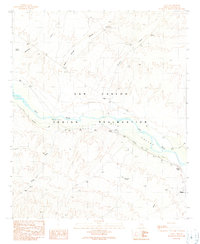
1989 Map of Calva
USGS Topo · Published 1990About this map
The San Carlos Indian Reservation occupies the heart of this landscape, where the Gila River winds through the Gila Valley in southeastern Arizona. The settlement of Bylas stands as the primary community hub on the eastern edge of the quadrangle, featuring multiple local cemeteries and proximity to Navajo Point. Moving northwest along the Coolidge Dam Road, the smaller settlement of Calva appears near the riverbanks, marking a point of intersection between the valley floor and the surrounding high desert drainages.
Find a feature on this map
27 named features on this map. Tap any name to fly to it.
Don’t see what you’re looking for? This feature index may not catch every label — zoom into the map to look around manually.
Map Details
Editions of this 1989 Calva Map
This is the sole edition of this map. No revisions or reprints were ever made.
Other maps of this area

1954 · Mesa
USGS Topo · 1:250,000

1957 · Mesa
USGS Topo · 1:250,000

1958 · Mesa
USGS Topo · 1:250,000

1960 · Mesa
USGS Topo · 1:250,000

1960 · Bylas
USGS Topo · 1:62,500

1962 · San Carlos Reservoir
USGS Topo · 1:62,500

1964 · Mesa
USGS Topo · 1:250,000

1966 · Branaman Spring
USGS Topo · 1:24,000
1966 · Ash Creek Ranch
USGS Topo · 1:24,000
1966 · Mount Triplet
USGS Topo · 1:24,000